फलकम्:Geobox/sample
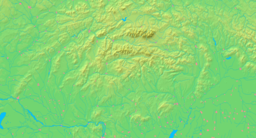
| Greater Fatra (Veľká Fatra) | |
| Range | |
Typical terrain of the Hôľna Fatra
| |
| Official name: Pohorie Veľká Fatra | |
| Name origin: Unknown | |
| Motto: Live with bears | |
| Nickname: Lovely mountains | |
| Countries | Slovakia, China |
|---|---|
| Regions | Žilina, Banská Bystrica |
| Districts | Martin, Ružomberok, Turčianske Teplice, Banská Bystrica |
| Municipality | Braľná Fatra |
| Part of | Outer Western Carpathians |
| Tributaries | |
| - left | Turiec |
| - right | Váh, Hron |
| Cities | Blatnica, Necpaly |
| Landmarks | vodopád, jaskyňa |
| - elevation | फलकम्:Unit height |
| - coordinates | ४९°२९′९″ उत्तरदिक् १३°३४′५६″ पूर्वदिक् / 49.48583°उत्तरदिक् 13.58222°पूर्वदिक् |
| Highest point | Ostredok |
| - elevation | फलकम्:Unit height |
| - coordinates | ४८°५४′६.२″ उत्तरदिक् १९°०४′४४″ पूर्वदिक् / 48.901722°उत्तरदिक् 19.07889°पूर्वदिक् |
| Lowest point | Rock bottom |
| - coordinates | १२°१५′१४″उत्तरदिक् ११८°१५′२१″पश्चिमदिक् / 12.254°उत्तरदिक् 118.2558°पश्चिमदिक् |
| Length | ४५ km (२८ mi), NE-SW |
| - length 1 | २७ km (१७ mi) |
| Width | २० m (६६ ft), NW-SE |
| - width 1 | ७७ m (२५३ ft) |
| - width 2 | १२५ m (४१० ft) |
| Height | २०.२५ m (६६.४४ ft) |
| - Height 1 | ७७.१२ km (४७.९२ mi) |
| - Height 2 | १२५.१ m (४१०.४३ ft) |
| Volume | फलकम्:Unit volume |
| Basin | १२,९३५ km2 (४,९९४ sq mi) |
| Area | ६०.३ sq mi (१५६ km2) |
| - land | ५४.० sq mi (१४० km2) |
| - water | ६.३ sq mi (१६ km2), 10.45% |
| - urban | १५ sq mi (३९ km2) |
| - metro | १६ sq mi (४१ km2) |
| - area 1 | ३३ sq mi (८५ km2), 55% |
| Discharge | for London |
| - average | फलकम्:Unit discharge |
| Density | फलकम्:Unit area density |
| - urban | फलकम्:Unit area density |
| - metro | फलकम्:Unit area density |
| UNESCO World Heritage Site | |
| Name | Vlkolínec |
| Website: my.opera.com | |
| I wandered lonely o'er vales and hills | |
Sample template
सम्पादयतुThe template to the right is just a sample to show the many fields the new Geoboxes can accept. Though it's based on a real location, much data in this sample is just nonsense.


